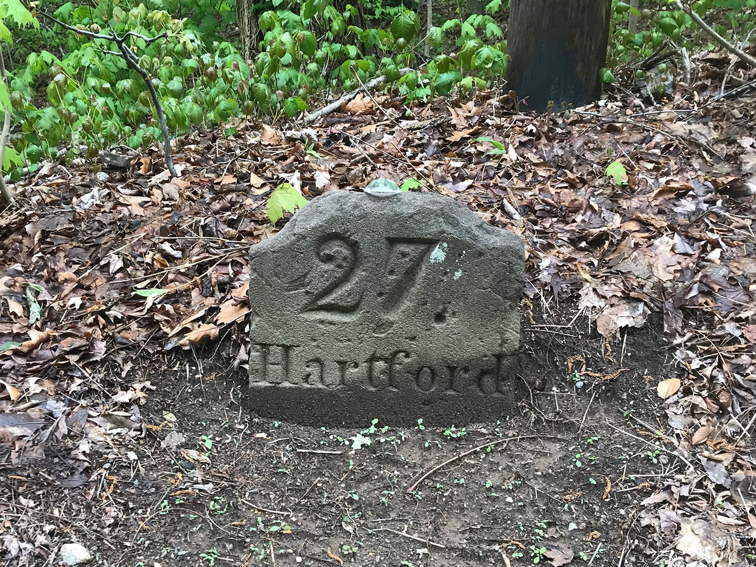
Historic Mile Markers Along the Middlesex Turnpike
As early as 1767, Connecticut law required towns to “install stones at least two feet high near the side of the common traveling road, marked with the distances from the county town of the county where such towns lyes.” Haddam was located in Hartford County until Middlesex County was formed in 1785, so early mile markers would have indicated the mileage to Hartford. Some of these markers may have been installed in Haddam during the first decade of the 19th century when the Middlesex Turnpike opened along Route 154 and Walkley Hill Road.
Remarkably, Haddam has at least five of these mile markers remaining along the once busy toll road. Three are original and two are from a Department of Transportation program in the 1970s to replace lost milestones.
 Mile marker 23 is original and is located along the east side of Walkley Hill Road where it is cared for by area residents. Mile Marker 24 is also found along Walkley Hill, near the intersection of Meetinghouse Road, and is also original and made of brownstone.
Mile marker 25 is located in front of Town and Country Nurseries and is a modern replacement. Mile Marker 26 is found along Route 154 at 1266 Saybrook Road near the southern end of Old Turnpike Road and is also a later replacement stone. Marker 27 is located just to the south of 1426 Saybrook Road near a large rock outcropping.
Where are the others?
According to a Hartford Courant article from 1970 Haddam residents were “perplexed” when mile marker 21 suddenly appeared along Route 9A just south of Larry’s Garage. The original marker had been missing for years and presumably stolen. The new marker was part of a program of CT DOT to replace the missing or demolished markers along Connecticut’s 13 historic “Pikes.” The new mile marker 21 was not without controversy. According to residents the original marker would have been located on Boulder Dell Road which was the original turnpike road but conceded that it would be visible along the main road. After walking Route 154 and talking with area businesses, we have not been able to locate mile marker 21.
Marker 22 was located directly on the highway in front of 373 Saybrook Road and in 2019 was removed by a crew who said they were with the Connecticut Department of Transportation. Follow-up calls with ConnDOT indicated they had no record of anyone removing the stone or why it was taken.
Historically there would have been another marker at mile 28 near the RT. 82 Connector. Mile 29 is located just on the Chester Town Line.
The mile markers are a unique tangible link to a time when foot and horses were the main means of ground transportation and remind us just how far we have come in the last 250 years. If anyone has information about missing mile marker 21, give us a call at 860.345.2400.
